Der Segen der Passatwinde. DER NEBEL DER GIPFEL
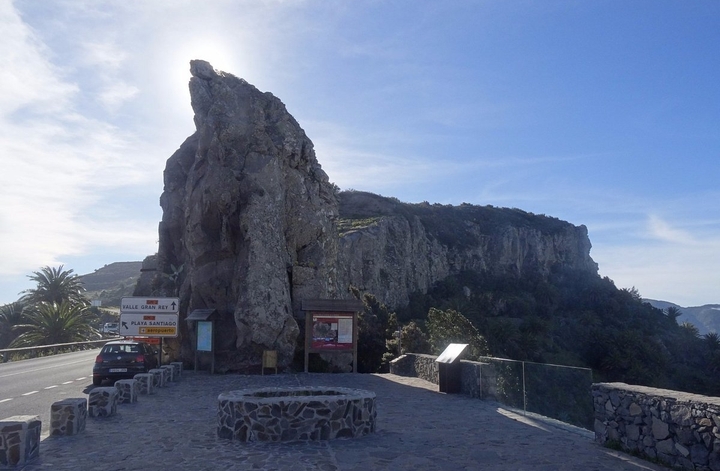
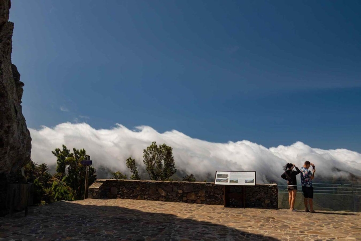
Wenn der Reisende La Gomera betritt und diese Straße in Richtung Nationalpark Garajonay hinaufsteigt, wird er von der radikalen Veränderung der Landschaft überrascht: Das niedrige Buschwerk wird schnell durch einen dichten Baumhain ersetzt, der an einen Dschungel erinnert. Mit Moos bedeckte Farne, Lianen und Bäume von etwa zwanzig verschiedenen Arten bilden ein Gewirr, durch das die Sonnenstrahlen kaum hindurchdringen. Wie ist es möglich, dass ein solcher Ort nur 400 Kilometer von der größten Wüste der Welt entfernt und auf demselben Breitengrad existiert? Die Antwort kann oft gefunden werden, wenn man sich von seinem Standort aus umschaut: Von hier aus ist das Phänomen, das als Wolkenmeer bekannt ist, an den meisten Tagen des Jahres sichtbar.
Die vom Azoren-Antizyklon geblasenen nordöstlichen Passatwinde werden auf ihrem Weg über den Atlantischen Ozean mit Feuchtigkeit aufgeladen. Wenn sie auf das Hindernis Insel stoßen, steigt die feuchte Luft auf und bildet Wolken, die die Hänge und Gipfel berühren. Während der Rest der Insel in herrlichem Sonnenschein scheint, werden die gut ausgerichteten Hänge mit einer langsamen, aber immensen Wasserzufuhr in Form winziger Tropfen geschmückt, die sich auf den Blättern der Bäume und Zweige ablagern. fallen zu Boden und versickern im Inneren der Insel. Dies und nicht der Regen ist der Faktor, der den relativen Wasserreichtum auf der Isla Colombina erklärt: der Schlüssel für die Existenz ihrer Jets und Quellen.
Es wird geschätzt, dass die Wassermenge, die durch die Passatwinde auf den gebirgigsten Inseln bereitgestellt wird, fünfmal so groß ist wie die Wassermenge, die durch herkömmliche Niederschläge entsteht. Aus diesem Grund gibt es auf La Gomera einen Lorbeerwald, der undenkbar wäre, wenn er ausschließlich auf die wenigen Winterregen angewiesen wäre.
HÖHE ALS SCHLÜSSELFAKTOR
Auf La Gomera liegt die maximale Höhe etwa auf der gleichen Höhe wie die Obergrenze des Nebels. Folglich profitieren teilweise auch die Gipfel des Südhangs, bevor sie am Leehang abfallen.

LA BENDICIÓN DE LOS VIENTOS ALISIOS. LA NIEBLA DE LAS CUMBRES
Cuando el viajero se adentra en La Gomera y sube por esta carretera hacia el Parque Nacional de Garajonay, se sorprende por la radical transformación del paisaje: el matorral bajo es rápidamente sustituido por una espesa arboleda, que tiene aspecto selvático. Helechos, lianas y árboles de una veintena de especies diferentes, cubiertos de musgo, forman una maraña que los rayos del sol apenas logran atravesar. ¿Cómo es posible que exista un lugar así a sólo 400 kilómetros del desierto más grande del mundo y en la misma latitud? La respuesta muchas veces se puede encontrar mirando a tu alrededor desde donde estés: desde aquí, el fenómeno conocido como mar de nubes es visible la mayor parte de los días del año.
Los vientos alisios del noreste, arrastrados por el anticiclón de las Azores, se cargan de humedad a su paso sobre el océano Atlántico. Cuando encuentran el obstáculo que es la isla, el aire húmedo se eleva y forma nubes que contactan con sus laderas y cumbres. Así, mientras el resto de la isla brilla con un sol espléndido, las laderas bien orientadas se benefician de una lenta pero inmensa aportación de agua, en forma de minúsculas gotas, que se depositan en las hojas de los árboles y en las ramas, caer al suelo y filtrarse hacia el interior de la isla. Éste, y no la lluvia, es el factor que explica la relativa abundancia de agua en la Isla Colombina: la clave que permite la existencia de sus chorros y manantiales.
Se estima que el volumen de agua aportado por los vientos alisios en las islas más montañosas equivale a cinco veces el obtenido mediante lluvias convencionales. De ahí la presencia de la laurisilva en La Gomera, que sería impensable si dependiera exclusivamente de las escasas lluvias invernales.
LA ALTITUD COMO FACTOR CLAVE
En La Gomera, la altitud máxima se sitúa aproximadamente a la misma altitud que el límite superior de la niebla. En consecuencia, también se benefician en parte las cimas de la vertiente sur, antes de descender por la vertiente de sotavento.

THE BLESSING OF THE TRADE WINDS. THE MIST OF THE SUMMITS
When the traveller enters La Gomera and climbs up this road towards Garajonay National Park, they are surprised by the radical transformation of the landscape: the low scrub is quickly replaced by a thick grove of trees, which has a jungle appearance. Ferns, lianas and trees of about twenty different species, covered with moss, form a tangle that the sun’s rays barely manage to pass through. How is it possible that such a place exists just 400 kilometres from the world’s largest desert, and at the same latitude? The answer can often be found by looking around you from where you are: from here, the phenomenon known as the sea of clouds is visible most days of the year.
The northeastern trade winds, blown by the Azores Anticyclone, are charged with moisture as they pass over the Atlantic Ocean. When they encounter the obstacle that is the island, the humid air rises and forms clouds that contact with its slopes and summits. Thus, while the rest of the island may be shining with splendid sunshine, the well-oriented slopes are graced with a slow but immense supply of water, in the form of tiny drops, which are deposited on the leaves of the trees and branches, fall to the ground and seep into the interior of the island. This, and not the rain, is the factor that explains the relative abundance of water on the Isla Colombina: the key that allows the existence of its jets and springs.
It is estimated that the volume of water provided by the trade winds in the most mountainous islands is equivalent to five times that obtained through conventional rainfall. This is the reason for the presence of the laurel forest in La Gomera, which would be unthinkable if it relied exclusively on the scarce winter rains.
Translation by IM-Translator
Frage/Pregunta/Question:
"Quader/cuboid/sillar" - Zähle die Quader/Count the cuboids/contar los cuboides - Zahl/number/número